Prettyearth - world atlas and maps, gps
Download URL | Author URL | Software URL | Buy Now ($9.95)
View beautiful maps of Earth with PrettyEarth! See current day and night regions, learn geography by taking the quiz, enjoy relief elevation surfaces and measure distances between locations! PrettyEarth lets you view vector and raster maps and images (such as country boundaries, world cities, rivers, satellite photos), search in geographically-referenced data, visualize and analyze spatial information, extend your knowledge by taking an educational quiz, and edit your own simple maps. PrettyEarth is a GIS program with the following features:
- support for vector maps (points, lines, areas)
- support for raster maps (terrain elevation and bathymetry, images, symbolic)
- displays maps of various planets
- supports GPS, logging GPS locations, wardriving and the "follow GPS" mode
- GPS fleet tracking service: PrettyEarth can regularly report locations so that you know where your fleet is, and others know where you are
- all maps are free:
- political: country boundaries with count
Related software (5)
IP2Location DB21 Database
IP2Location IP-COUNTRY-REGION-CITY-LATITUDE-LONGITUD E-ZIPCODE-TIMEZONE-AREACODE-ELEVATION is commercial IP geolocation translates IP address to country, region, city, latitude, lon ...
IP2Location DB22 Database
IP2Location IP-COUNTRY-REGION-CITY-LATITUDE-LONGITUD E-ZIPCODE-TIMEZONE-ISP-DOMAIN-NETSPEED-A REACODE-WEATHER-MOBILE-ELEVATION is commercial IP geolocation translates IP address to c ...
IP2Location Geolocation Database
IP2Location IP-COUNTRY-REGION-CITY-LATITUDE-LONGITUD E-ZIPCODE-TIMEZONE-ISP-DOMAIN-NETSPEED-A REACODE-WEATHER-MOBILE-ELEVATION-USAGETY PE is commercial IP geolocation translates IP ad ...
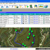
ediTrail
Create/Edit/Display/Management/Import/Ex port Trails/Routes in a simple and flexible environment divided in a data table for the management of trails and a map resulting from numero ...
ORTWIN
ORTWIN is a program for the inquiry of localities in Germany. It finds postal zip codes, telephone pre selections, coordinates. It performs perimeter searches and distance calculat ...