Geodata germany
Download URL | Author URL | Software URL | Buy Now ($165)
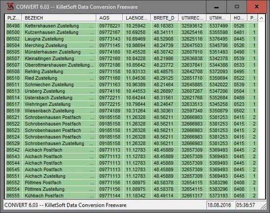
The database tables contains geodata of the Federal Republic of Germany with geo referenced towns, municipalities, town quarters and other administrative units, postal codes, telephone preselections, nature areas, landscapes, climatic zones and official topographical cartographies. The data contain coordinates for navigation and geo-coding, proximity searches and distance computations and are prepered for the spatial mapping of environmental information. Quite often it is necessary to reference an address field e.g. like town or municipality name, postal code or telephone preselection, to corresponding geographical data and coordinates - a Geo Reference. The geo reference can be used e.g. to direct a customer to the closest store locations of a retail store chain by doing a proximity search. Another possibility it to determine distances between the different objects of the database tables with the included geo references. With the elevation data from a Digital Elevation Model the groun
Related software (5)

Our Beautiful Earth
See our Earth's beauty in high-resolution! Fully customizable by you - you can change the size of the images as well as the transitions of the slide show. Download this screensaver ...

east-tec SafeBit
east-tec SafeBit 2 features military strength on-the-fly AES encryption, by creating virtual drives, where you can hide files and folders, keep them encrypted all them time, but st ...

Geodata International
Geodata International - World-wide database of countries with georeferenced towns, municipalities, postal codes and administrative units with WGS84 and UTM coordinates and elevatio ...

ORTWIN
ORTWIN is a program for the inquiry of localities in Germany. It finds postal zip codes, telephone pre selections, coordinates. It performs perimeter searches and distance calculat ...

GeoDLL
GeoDLL supports the development of geodetic software on various platforms by providing geodetic functions. GeoDLL contains precise calculations on the themes 2D and 3D coordinate t ...
